Portal:Tropical cyclones
The Tropical Cyclones Portal
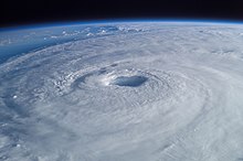
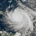
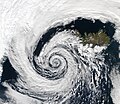
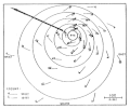
A tropical cyclone is a storm system characterized by a large low-pressure center, a closed low-level circulation and a spiral arrangement of numerous thunderstorms that produce strong winds and heavy rainfall. Tropical cyclones feed on the heat released when moist air rises, resulting in condensation of water vapor contained in the moist air. They are fueled by a different heat mechanism than other cyclonic windstorms such as Nor'easters, European windstorms and polar lows, leading to their classification as "warm core" storm systems. Most tropical cyclones originate in the doldrums, approximately ten degrees from the Equator.
The term "tropical" refers to both the geographic origin of these systems, which form almost exclusively in tropical regions of the globe, as well as to their formation in maritime tropical air masses. The term "cyclone" refers to such storms' cyclonic nature, with anticlockwise rotation in the Northern Hemisphere and clockwise rotation in the Southern Hemisphere. Depending on its location and intensity, a tropical cyclone may be referred to by names such as "hurricane", "typhoon", "tropical storm", "cyclonic storm", "tropical depression" or simply "cyclone".
Types of cyclone: 1. A "Typhoon" is a tropical cyclone located in the North-west Pacific Ocean which has the most cyclonic activity and storms occur year-round. 2. A "Hurricane" is also a tropical cyclone located at the North Atlantic Ocean or North-east Pacific Ocean which have an average storm activity and storms typically form between May 15 and November 30. 3. A "Cyclone" is a tropical cyclone that occurs in the South Pacific and Indian Oceans.
Selected named cyclone -
Typhoon Sarah, known as the Miyakojima Typhoon in Japan, was a destructive typhoon, and among the deadliest on record in the western Pacific Ocean, killing around 2,000 people. It formed during the peak of the busy 1959 Pacific typhoon season near Guam, and moved generally to the west-northwest. Continued observations from the hurricane hunters allowed the Joint Typhoon Warning Center (JTWC) to track Sarah from its origins to its peak as a powerful typhoon, with maximum sustained winds estimated at 305 km/h (190 mph) on September 15. Shortly thereafter, the typhoon struck the small Japanese island of Miyako-jima, where the barometric pressure fell to 908.1 mbar (26.82 inHg), the second-lowest on record for the country. Sarah turned to the north and northeast, weakening from its peak intensity. On September 17, the typhoon made landfall just west of Busan, South Korea with winds of 185 km/h (115 mph), the nation's strongest landfall at the time and only to be surpassed by Typhoon Maemi in 2003. Sarah later became extratropical over the Japanese island of Hokkaido on September 18, although the remnants persisted for several days, crossing into the Russian Far East and later dissipating on September 23.
On Miyako-jima, Sarah damaged all of the crops and destroyed about 6,000 houses. Damage was estimated at $2 million, and there were seven deaths. The damage prompted the Japan Meteorological Agency to give Sarah the special name of the "Miyakojima Typhoon". However, the effects were worst in South Korea, and Sarah was described as the worst typhoon there in 50 years. Wind gusts there peaked at 169 km/h (105 mph), the highest at the time in the country. High winds and waves heavily damaged the port of Busan. Nationwide, the storm destroyed over 14,000 homes and left 782,126 people homeless, causing over $100 million in damage. At least 669 people were killed in South Korea, and an additional 1,200 fishermen were lost offshore the country. In Japan, widespread flooding killed 47 people and destroyed 16,632 homes. (Full article...)Selected article -
The effects of Hurricane Wilma in Mexico severely affected the tourism industry of the Yucatán Peninsula in mid October 2005. Hurricane Wilma developed on October 15 in the Caribbean. Four days later, it intensified into the strongest Atlantic hurricane on record as determined by barometric pressure. Wilma weakened as it moved slowly northwestward, eventually making landfall late on October 21 on the island of Cozumel. At the time, it was a Category 4 hurricane on the Saffir–Simpson scale. Early the next day, the hurricane made another landfall on the Mexican mainland near Puerto Morelos. Wilma exited the Yucatán Peninsula into the Gulf of Mexico on October 23, and a day later it struck Florida.
The large and powerful hurricane dropped torrential rainfall across the northeastern Yucatán Peninsula and on offshore islands. Over a 24-hour period, Wilma produced 1,633.98 mm (64.330 in) of rainfall, the greatest 24-hour accumulation ever recorded in the Western Hemisphere. Parts of the Yucatán Peninsula experienced tropical storm-force winds for nearly 50 hours. An anemometer recorded a reading of 212 km/h (132 mph) before the instrument failed. The hurricane moved ashore with an estimated 4.6 m (15 ft) storm surge, accompanied by 5 to 8 m (16 to 26 ft) waves which reached the third stories of some buildings. Wilma severely eroded the beaches of eastern Quintana Roo and caused flooding in neighboring Yucatán. (Full article...)Selected image -

Selected season -

The 2018 Atlantic hurricane season was the third in a consecutive series of above-average and damaging Atlantic hurricane seasons, featuring 15 named storms, 8 hurricanes, and 2 major hurricanes, which caused a total of over $50 billion (2018 USD) in damages and at least 172 deaths. More than 98% of the total damage was caused by two hurricanes (Florence and Michael). The season officially began on June 1, 2018, and ended on November 30, 2018. These dates historically describe the period in each year when most tropical cyclones form in the Atlantic basin and are adopted by convention. However, subtropical or tropical cyclogenesis is possible at any time of the year, as demonstrated by the formation of Tropical Storm Alberto on May 25, making this the fourth consecutive year in which a storm developed before the official start of the season. The season concluded with Oscar transitioning into an extratropical cyclone on October 31, almost a month before the official end.
Although several tropical cyclones impacted land, only a few left extensive damage. In mid-September, Hurricane Florence produced disastrous flooding in North Carolina and South Carolina, with damage totaling about $24 billion. The storm also caused 54 deaths. About a month later, Hurricane Michael, the first tropical cyclone to strike the United States as a Category 5 hurricane since Hurricane Andrew in 1992, left extensive damage in Florida, Georgia, and Alabama. Michael caused approximately $25 billion in damage and at least 64 deaths. Since Michael reached Category 5 status, 2018 became the third consecutive season to feature at least one Category 5 hurricane. Hurricane Leslie resulted in the first tropical storm warning being issued for the Madeira region of Portugal. Leslie and its remnants left hundreds of thousands of power outages and downed at least 1,000 trees in the Portuguese mainland, while heavy rains generated by the remains of the cyclone caused 15 deaths in France. The storm left approximately $500 million in damage and 16 fatalities. (Full article...)Related portals
Currently active tropical cyclones

Italicized basins are unofficial.
- North Atlantic (2024)
- No active systems
- East and Central Pacific (2024)
- No active systems
- West Pacific (2024)
- No active systems
- North Indian Ocean (2024)
- No active systems
- Mediterranean (2023–24)
- No active systems
- South-West Indian Ocean (2023–24)
- No active systems
- Australian region (2023–24)
- Tropical Low 12U
- South Pacific (2023–24)
- No active systems
- South Atlantic (2023–24)
- No active systems
Last updated: 07:47, 13 April 2024 (UTC)
Tropical cyclone anniversaries

April 14,
- 1985 - Cyclone Gretel passed directly over Darwin causing extensive damage but no fatalities. Gretel inflicted a total of $3.5 million worth of damage.
- 1986 - Cyclone Martin (pictured) slowly weakens from a severe tropical cyclone after affecting Fiji.

April 15
- 1952 - A cyclone in Tanzania became the strongest ever landfall in the country, causing 34 fatalities.
- 2000 - Cyclone Neil (pictured) reached its peak intensity with a central pressure of 992 hPa (mbar). Neil brought heavy rains to Fiji.
- 2009 - Cyclone Bijli becomes a named storm over in the Bay of Bengal. Bijli later killed a total of 7 people.

April 16
- 1978 - Cyclone Hal starts becoming extratropical while it affects New Zealand from a severe tropical cyclone.
- 2003 - Typhoon Kujira (pictured) reached its peak intensity with winds of 250 km/h (155 mph) in the Philippine Sea. Kujira killed 2 people on Pohnpei in Micronesia.
Did you know…


- …that the Joint Typhoon Warning Center considers that Typhoon Vera (pictured) of 1986 is actually two distinct systems, formed from two separated low-level circulations?
- …that Hurricane Agatha (pictured) was the strongest Pacific hurricane to make landfall in Mexico in May since records began in 1949?
- …that Cyclone Raquel (track pictured) travelled between the Australian and South Pacific basins between the 2014–15 and 2015–16 seasons, spanning both seasons in both basins?
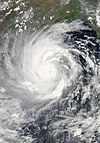
- …that Cyclone Amphan (pictured) in 2020 was the first storm to be classified as a Super Cyclonic Storm in the Bay of Bengal since 1999?
General images -

Topics
Subcategories
Related WikiProjects
WikiProject Tropical cyclones is the central point of coordination for Wikipedia's coverage of tropical cyclones. Feel free to help!
WikiProject Weather is the main center point of coordination for Wikipedia's coverage of meteorology in general, and the parent project of WikiProject Tropical cyclones. Three other branches of WikiProject Weather in particular share significant overlaps with WikiProject Tropical cyclones:
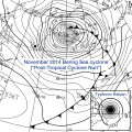
- The Non-tropical storms task force coordinates most of Wikipedia's coverage on extratropical cyclones, which tropical cyclones often transition into near the end of their lifespan.
- The Floods task force takes on the scope of flooding events all over the world, with rainfall from tropical cyclones a significant factor in many of them.
- WikiProject Severe weather documents the effects of extreme weather such as tornadoes, which landfalling tropical cyclones can produce.
Things you can do
 |
Here are some tasks awaiting attention:
|
Wikimedia
The following Wikimedia Foundation sister projects provide more on this subject:
-
Commons
Free media repository -
Wikibooks
Free textbooks and manuals -
Wikidata
Free knowledge base -
Wikinews
Free-content news -
Wikiquote
Collection of quotations -
Wikisource
Free-content library -
Wikiversity
Free learning tools -
Wikivoyage
Free travel guide -
Wiktionary
Dictionary and thesaurus


